For my fellow hams on the forum, I did a fun project over the last few days.
I recently got two different SDRs. One is the HackRF One, and the other is the RTL-SDR. The RTL-SDR came as a kit with some nice antennas, and some projects only support the RTL-SDR, so it was definitely still worth getting. The HackRF is the much nicer one of the two though, and the price shows it.
I did a few different mods to the HackRF (soldered on EMI shielding for the amp circuit, installed an internal TCXO, and an aluminum enclosure is on the way), and I’ve been getting great results.
I’ve done a lot of the more basic things with it:
- Listening to AM and FM radio (music)
- Listening to air traffic control, and the normal ham bands
- Using software like dump1090 to pull and map aircraft telemetry data from 1090MHz
- Used it to replay button presses on my RF controlled ceiling fan
But, I decided I wanted to try pulling images from the NOAA weather satellites. They’re IR, and the signal is all analog.
I just used a V dipole type antenna (rabbit ears), horizontally. This is a good guide to this type of antenna. My RTL-SDR kit came with a telescoping dipole, so I was able to tune that for 137MHz.
My first few attempts didn’t go well. The first time I didn’t aim it correctly, and while I got a tiny bit of the signal (enough for a tiny bit of telemetry data), I didn’t get any usable picture data. The second time, my laptop unknowingly had 0 bytes free, and when I went to record, my SDR software crashed with no error message. It took me too long to figure out what was going on, and I missed the pass.
I had considered waiting and making a double cross antenna, which I’ll still likely do in the future, but I didn’t have any 50 ohm coax cable, and I couldn’t find anywhere to source it locally.
I found a good pass tonight from NOAA-18, and went for it. I tried attaching the antenna to a tripod, but I ended up having to just grab it and manually aim it by hand. I could recognize the sound of the encoded data, and I was able to track the satellite as it moved across the sky. As mentioned, it’s analog, so there’s a lot of wiggle room. It doesn’t have to be perfect.
Here’s a video from when I was actually recording the satellite data.
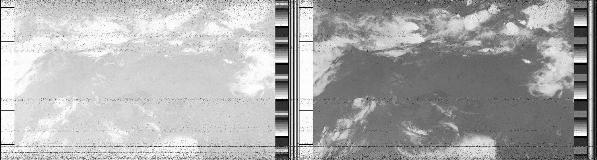
I saved the audio as a WAV, resampled it at the needed rate for the decoding software (wxtoimg), and started to decode it. It worked fantastically 
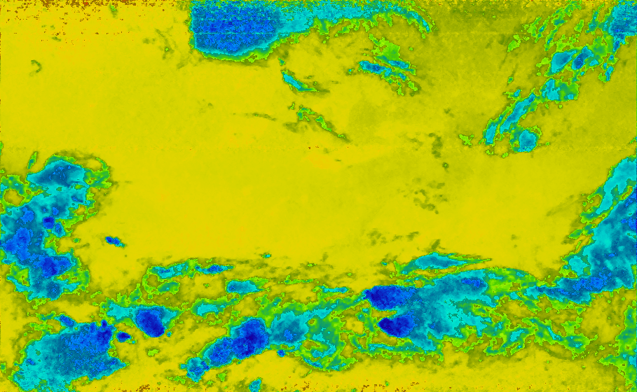
It also encodes a lot of other data, including sea/water temp data.
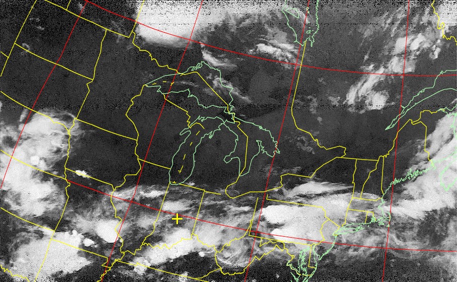
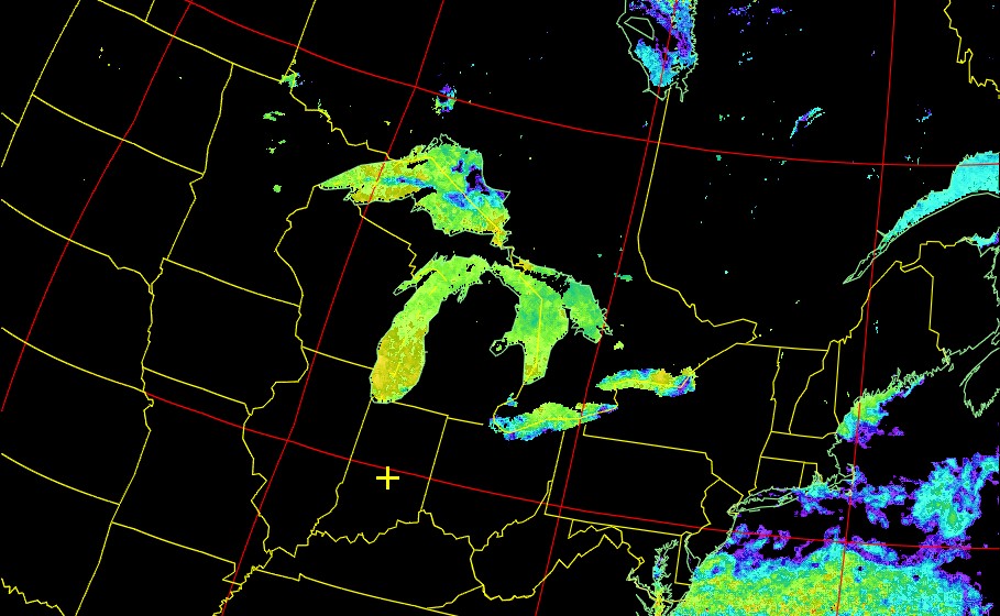
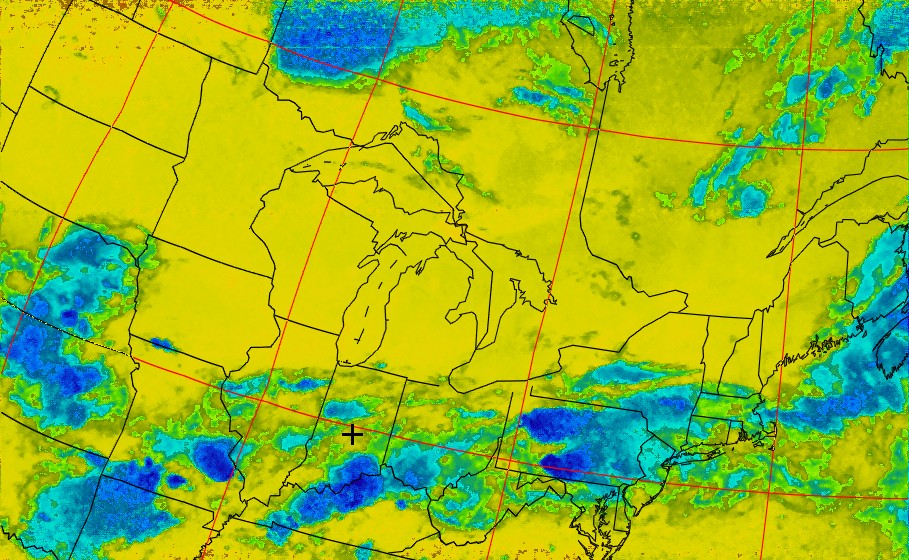
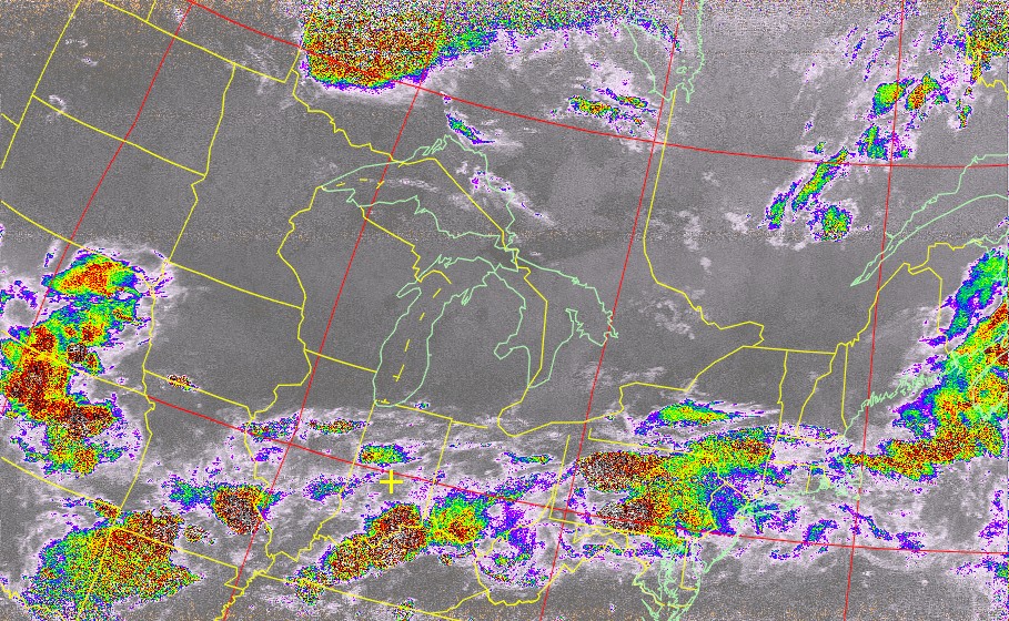
Some of these images have a map overlay. The satellite gives telemetry data, and the decoding software I use was then able to add a map overlay. It helps give perspective on the images. It’s not always a perfect line-up, but it’s decent enough.
Here’s a few good ones as a teaser, I’ll throw the rest of the ones I decoded in a little expandy thing. Underneath some of the images I’ll put the same image, with the map outline.
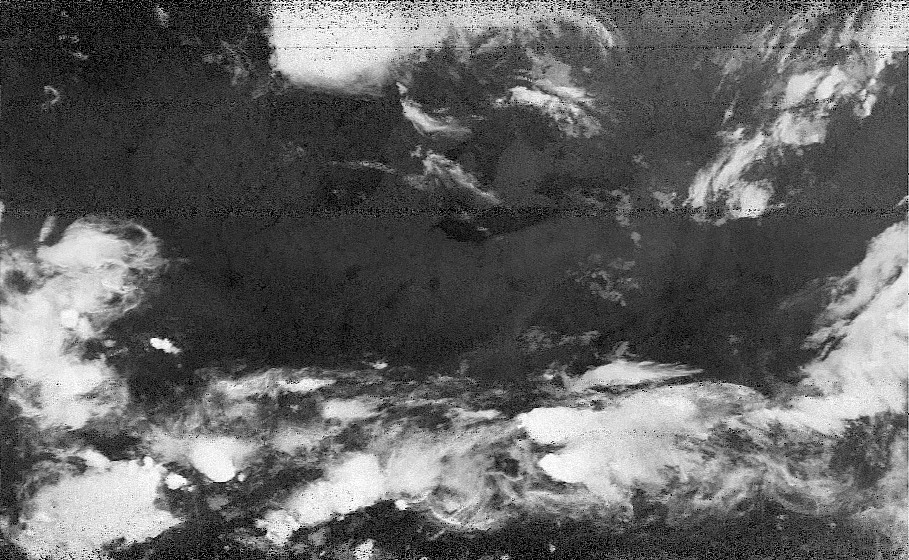
You can see the great lakes  Keep in mind, this was taken at 10:50pm, so the grayscale images are a bit dark.
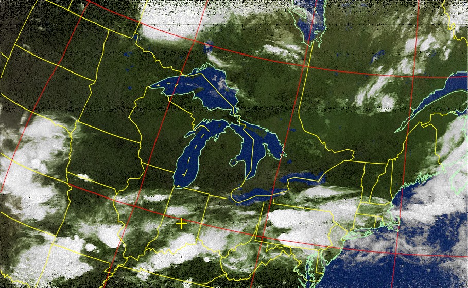
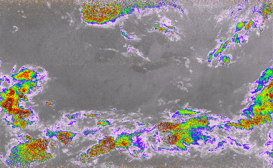
This one uses the IR data to create false color images, did a surprisingly good job. Again, this was taken at night, so of course it wouldn’t be this bright in actuality haha
The rest of the images!
This is the first raw image, showing both channels, no modifications. You can also see a bit of the non-image data.
These two are the sea temp images, which also show the temperature of the great lakes right now. You can see the atlantic in the right side.
These last 2 are both different types of thermal images.
It’s insane to me that these were all pulled LIVE from a passing satellite, with a few hundred dollars worth of equipment. Most people do it with the RTL-SDR, so it could be done for <$50, but the HackRF has a more powerful amp (plus it’s better shielded, and I’m surrounded by EMI).
If anyone is interested, I can make a more thorough how-to type post as well. It’s pretty off-topic to the forum, but hoping there’s enough intersection that people will find it interesting.